This map outlines the area of interest for restoration trials of subtidal shellfish reefs. It is a historic map of the dredge section numbers 30, 32 and 33 as they existed in the late 1800’s. 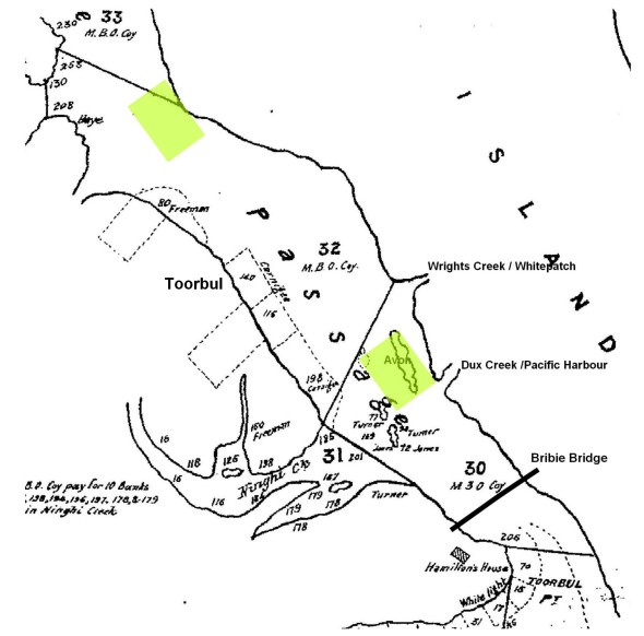
Since that time, a large amount of urban development has occurred in the region, mostly within the last 50 years. This has resulted in significant degradation of water quality which has adversely affected natural recruitment of subtidal shellfish populations in the region.
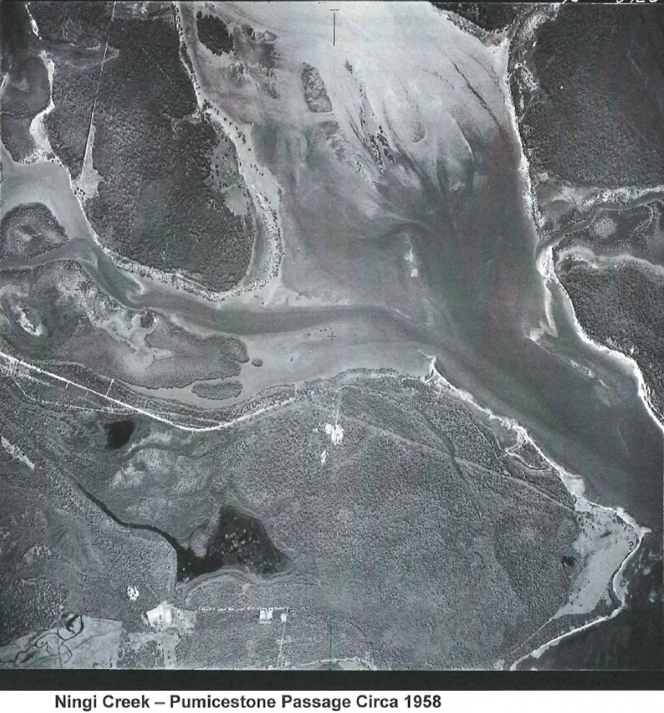
Aerial photo of Ningi Creek and Pumicestone Passage in 1958. Note the absence of urban development.
For the last 3 years we have worked towards obtaining permissions to conduct shellfish reef restoration trials in the area just north of Pacific Harbour so we can obtain the relevant permits to allow Phase 2 (Research and Development) to go ahead.
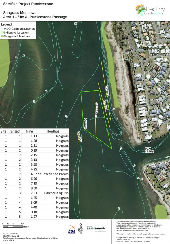
In Late November 2017, permissions were granted to conduct trials in a reduced part of the area of interest (Map of approved trial area). The trial reefs were deployed on the 12th December 2017 and marked with a special yellow marker buoy. Additional patch reefs with larger fence modules were deployed on 10th December 2018. 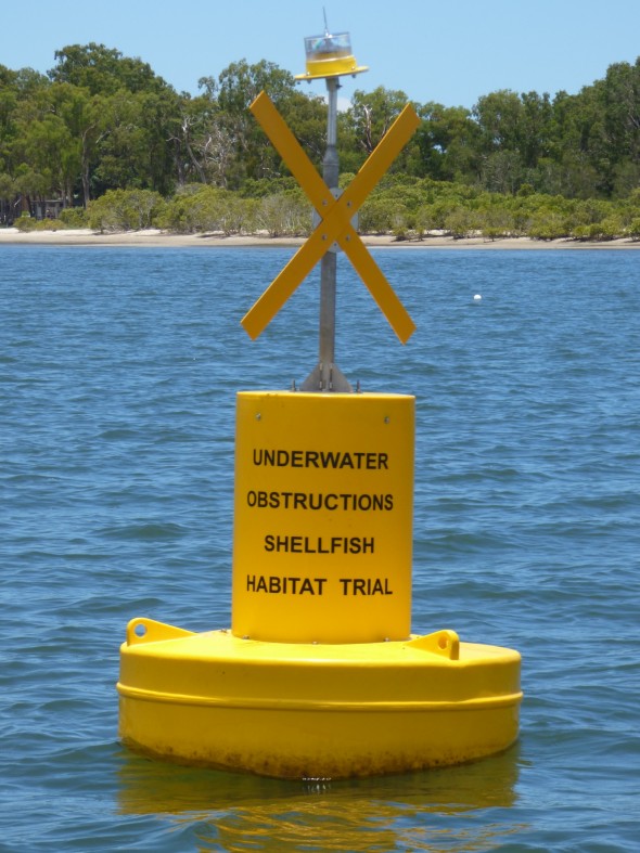 Results to date are encouraging, including a doubling of fish numbers and impressive recruitment of invertebrates and fish to the trial reefs. Fishers and boaties will of course still be allowed to fish in the area, but we ask that please don’t anchor in the area within 80 meters of the marker buoy, as the trial reefs will be easily damaged (and the science disrupted) by anchor damage.
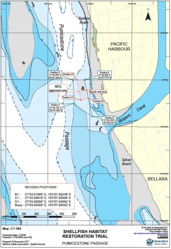
Map of the approved shellfish reef trial area. Boaties and fishers are asked not to anchor within 80 meters of the yellow marker buoy to avoid damaging the shellfish reef units.
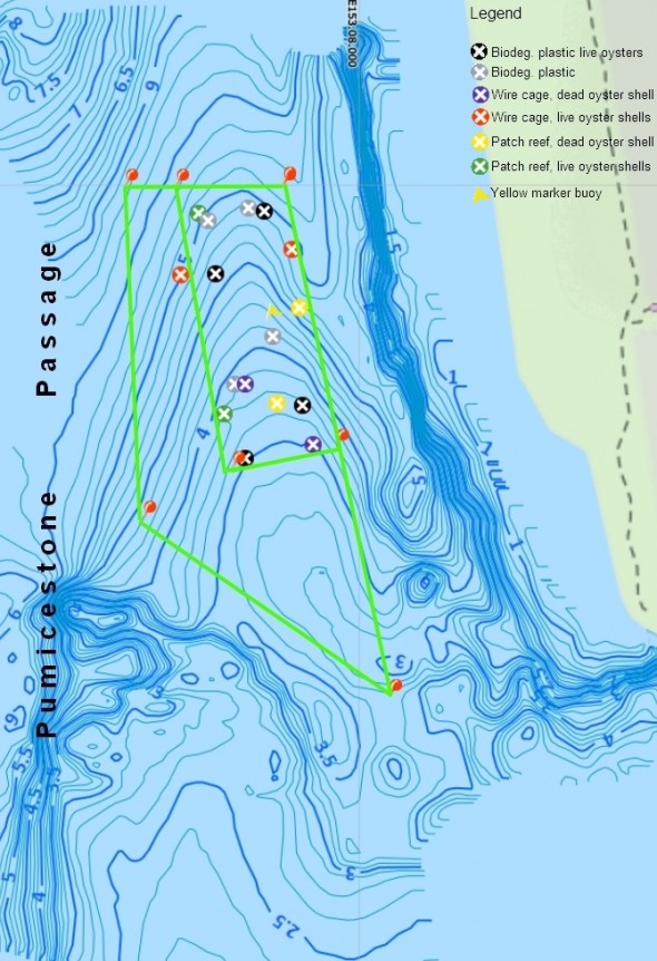
Location and types of experimental reef modules deployed in Pumicestone Passage.
Fred Palin says
Good to see someone understands Coastal Ecosystems and the importance of this Ramsar wetland.